Welcome to the Storm Tracking & Service Advisory Page
This page is here to provide hurricane and severe weather updates for the Keyes Associates, Employees and partners.
Every branch has a business continuity plan; as part of that plan you should have Hurricane Box, please locate it in preparation for this season.
If you don't have a box or are missing certain items, here is a list of what you should have.
- A copy of Hurricane Instructions and Preparation Guide
- Garbage Bags to cover computers and equipment
- Duct Tape
- Disposable Camera or Digital Camera/Phone
- Flashlight and extra Batteries
Please restock your box if you are missing items.
Notify Support immediately if you are in need of a new Hurricane Box.
Some sites to keep in mind during this Hurricane Season:
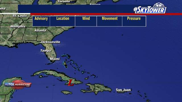
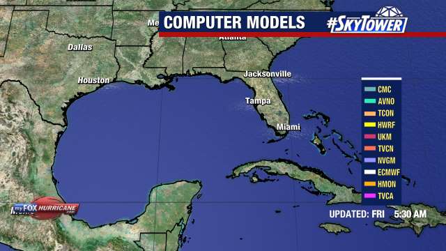
National Hurricane Center http://www.nhc.noaa.gov/
Weather Underground http://www.wunderground.com/tropical/
Thank you for your attention to these important items.
Stay safe, and pray for a quiet Hurricane season. 🙂
P.S. You can call in to listen to a pre-recorded message at Telephone at the Hurricane Hotline 1-877-KEYES-HELP (or 305.779.1999)

- NOAA Forecast
ZCZC MIATWOAT ALL
TTAA00 KNHC DDHHMM
Tropical Weather Outlook
NWS National Hurricane Center Miami FL
800 AM EDT Tue Oct 8 2024
For the North Atlantic...Caribbean Sea and the Gulf of Mexico:
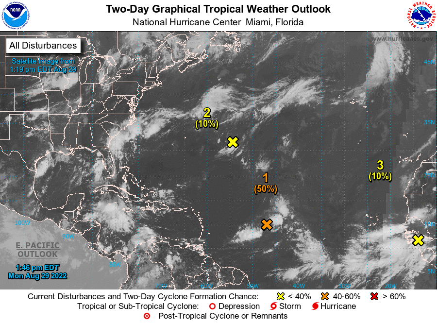
Active Systems:
The National Hurricane Center is issuing advisories on Tropical
Storm Leslie, located over the central tropical Atlantic Ocean, and
on Hurricane Milton, located over the southern Gulf of Mexico.
1. Southwestern Atlantic:
A broad area of low pressure is near the northern Bahamas with
disorganized shower and thunderstorm activity. Some development of
this system is possible during the next day or so while the low
moves northeastward to east-northeastward around 15 mph. Upper-
level winds are likely to increase later in the week, which should
limit further development.
* Formation chance through 48 hours...low...20 percent.
* Formation chance through 7 days...low...20 percent.
2. Eastern Tropical Atlantic:
A tropical wave is expected to move off the west coast of Africa in
a couple of days. Afterward, environmental conditions appear only
marginally favorable for some limited development of this system
while it moves westward or west-northwestward across the eastern
tropical Atlantic, moving near the Cabo Verde Islands on Thursday or
early Friday.
* Formation chance through 48 hours...low...near 0 percent.
* Formation chance through 7 days...low...20 percent.
Forecaster Blake